Up to this point, our journey through meteorological instruments has kept us firmly anchored to the ground—watching the coconut fronds, catching rainwater in cylinders, reading thermometers in louvered screens, and tracking pressure on barometers.
Yet, surface weather is merely the byproduct of a massive, three-dimensional thermodynamic engine unfolding miles above our heads. A storm forming over the Koro Sea or a drought gripping the islands cannot be fully understood by looking only at the soil. To truly decode the sky, meteorologists must send their instruments aloft.
Following our exploration of surface pressure, this fifth part of our series examines upper-air observations—the specialized techniques that probe the invisible layers of the troposphere and stratosphere.
The upper-air dimension
The atmosphere is a deep ocean of air extending dozens of kilometres upward, but nearly all of our weather—clouds, rain, wind shear, and severe turbulence—happens in the lowest layer, known as the troposphere.
Surface observations tell us what is happening at the bottom of this ocean, but forecasting future conditions requires knowing the temperature, humidity, and wind speed at 5,000, 18,000, and 30,000 feet. Without vertical soundings, meteorologists would be like oceanographers trying to understand ocean currents by only dipping their toes in the surf.
Pilot balloons
The historical foundation of upper-air observation began with simple pilot balloons, affectionately known in weather stations as “pibals.” These small, highly visible latex balloons are inflated with hydrogen or helium to a precise buoyant lift.
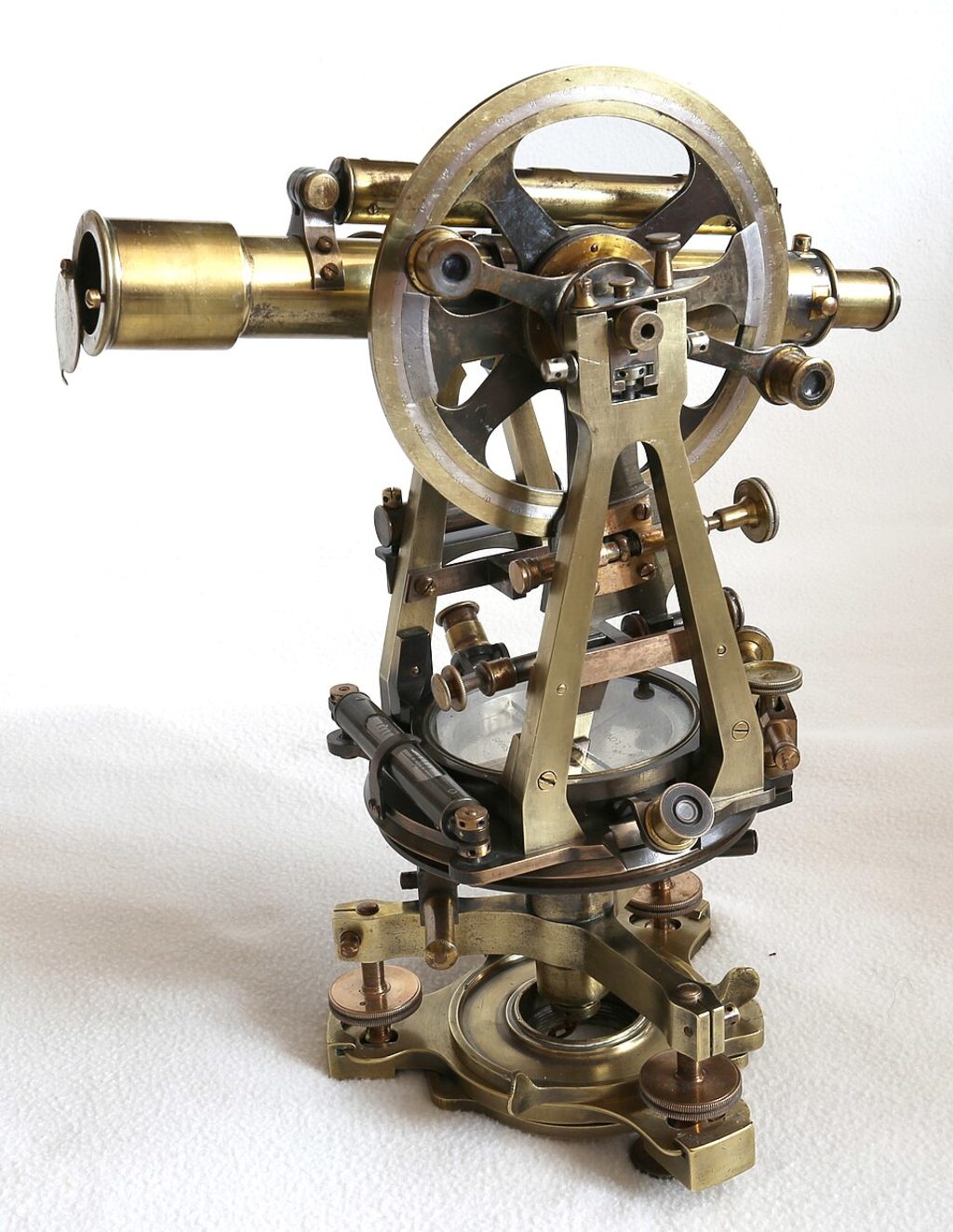
Released into the open air, the balloon ascends at a steady, predetermined rate of climb. Observers on the ground track its exact flight path through a specialized optical telescope called a theodolite, noting azimuth and elevation angles every minute. By applying simple trigonometry to these angles, forecasters calculate wind speed and direction at successive altitude layers, revealing the steering winds aloft.
Optical theodolites
Tracking a tiny balloon drifting miles away through a shifting sky requires immense patience and precision. The optical theodolite acts as a specialized surveying instrument designed specifically for meteorology.
Equipped with crosshairs and delicate Vernier scales for measuring horizontal and vertical angles, the observer locks onto the ascending balloon and follows its movement second by second. While beautifully simple and reliable, optical tracking has one major weakness: it relies entirely on clear visibility. If low, thick cumulonimbus clouds or heavy rain block the view, the balloon vanishes instantly, leaving the upper-air sounding incomplete.
Radar wind finding
To pierce through the heavy cloud cover and torrential downpours typical of tropical regions, meteorological services transitioned from optical tracking to electronic radar wind finding.
Instead of relying on visual sight, upper-air stations attach a small, specialized radar-reflective target—often shaped like a lightweight metallic tetrahedron—beneath the ascending balloon. A powerful ground-based tracking radar locks onto the metallic target, automatically following its exact spatial coordinates regardless of rain, fog, or darkness, and instantly computing high-resolution wind profiles through the boundary layer.
The radiosonde revolution
Tracking wind speed alone provides only part of the upper-air puzzle; meteorologists also need continuous measurements of temperature and moisture at every altitude. This led to the creation of the radiosonde in the mid-20th century.
A radiosonde is a marvel of miniaturized engineering: a battery-powered instrument package suspended beneath a weather balloon containing a digital thermometer, a capacitive hygrometer, and an aneroid barometer. As the balloon climbs through the freezing upper troposphere, the radiosonde samples ambient air conditions every few seconds, encoding the data into radio signals and transmitting them back to ground-receiving stations.
Global positioning systems
For decades, tracking the precise geographical position of a drifting radiosonde required complex ground-based radio direction-finding equipment. Today, modern radiosondes carry built-in Global Positioning System (GPS) receivers.
As the weather balloon is swept horizontally by upper-level jet streams and wind currents, the onboard GPS chip tracks its exact latitude, longitude, and altitude relative to orbiting satellites. This telemetry is beamed back to the surface in real time, allowing forecasters to derive exceptionally accurate high-altitude wind vectors and pressure levels with minimal ground equipment.
Isobaric mapping
The vast streams of vertical data collected twice daily by radiosonde networks across the globe are not used in isolation. Instead, they are plotted onto standard isobaric charts—representing constant pressure surfaces rather than fixed physical heights, such as the 850 hPa, 500 hPa, and 200 hPa levels.
This ingenious mapping technique allows forecasters to visualize upper-level troughs of low pressure, ridges of high pressure, and the roaring rivers of the jet stream. By understanding how these upper-level features steer surface weather systems, meteorologists can accurately anticipate whether a developing cloud cluster will fizzle out or intensify into a major tropical cyclone.
Aviation safety
Upper-air observations are vital to the safety and economics of global commercial aviation. Modern jetliners cruise smoothly in the upper troposphere and lower stratosphere—precisely where radiosondes map wind patterns and thermal layers.
Airlines rely on upper-air wind and temperature forecasts derived from these soundings to select optimal flight paths, avoid severe clear-air turbulence, and harness powerful tailwinds to cut flight times. This precise navigation saves millions of litres of jet fuel annually while ensuring passenger comfort across regional and international routes.
Climate tracking
Beyond daily aviation and forecasting, long-term upper-air archives are essential for monitoring global climate change. While surface thermometers show warming near the ground, radiosonde and satellite sounding records allow climatologists to track temperature trends throughout the entire depth of the troposphere and stratosphere.
These vertical profiles reveal critical fingerprints of anthropogenic climate change—such as tropospheric warming coupled with corresponding stratospheric cooling. By probing the invisible layers of the sky, upper-air measurements provide the multi-dimensional data needed to secure our understanding of a changing world.
n Dr Sushil K Sharma BA MA MEng (RMIT) PhD (Melbourne) is a World Meteorological Organisation (WMO) Accredited Class 1 Professional Meteorologist. He is also a former British Aerospace, The Royal Saudi Air Force and Bahrain Air Navigation Directorate Aviation Meteorologist; former Associate Professor of Meteorology, Fiji National University, and former Operational Meteorologist and Manager, Climate Research and Services Division, Fiji Meteorological Services. Mobile/WhatsApp +61481299080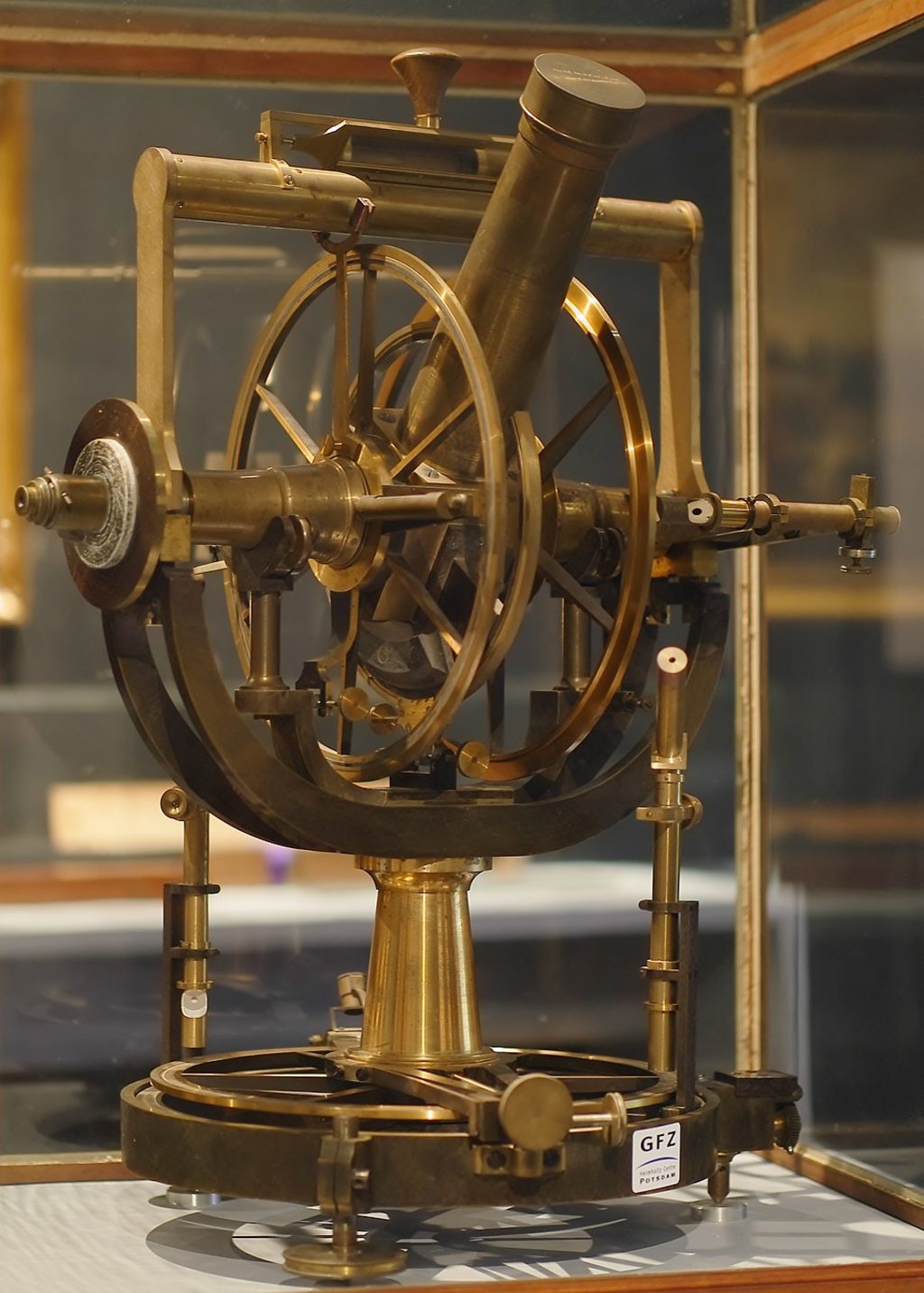
A theodolite in the 1800s.
Picture: EN.WIKIPEDIA.ORG
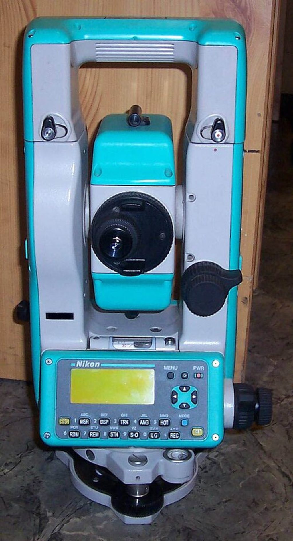
A modern theodolite is used with weather balloons.
Picture: EN.WIKIPEDIA.ORG