
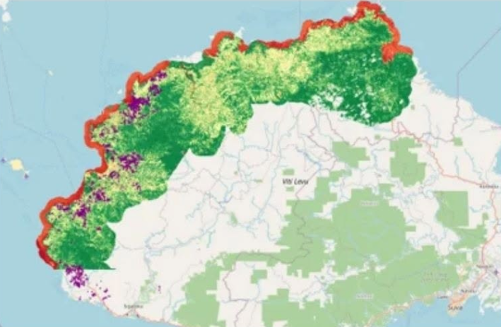
The Fiji Sugar Corporation (FSC) has set a November 2026 deadline to complete digital mapping of all sugarcane farms as it strengthens drought monitoring and crop forecasting through drone surveys, satellite imagery and remote sensing technology.
FSC management said 70 per cent of cane farms had already been digitally mapped as of September, with work continuing to cover all farming areas.
The initiative is designed to provide growers, Government and the sugar industry with earlier and more accurate information on crop conditions, particularly during periods of drought.
“The Fiji Sugar Corporation Limited (FSC) is strengthening its drought monitoring and crop assessment capabilities through a dedicated team of farm advisors across all cane sectors, supported by drone surveys, satellite imagery, geographic information system (GIS) technology and remote sensing tools,” the statement said.
FSC said the integrated approach would combine field assessments from individual farms with historical production data to improve crop monitoring and forecasting.
“Together, these initiatives will enable FSC, growers and Government to identify crop stress earlier, improve the accuracy of crop assessments and make more informed decisions in response to drought conditions.”
The corporation said the mapping exercise would also help verify farm boundaries and establish the area under sugarcane cultivation.
FSC plans to make digital farm maps accessible to growers through its Grower Portal App, allowing farmers to view their maps and support the updating of farm information.
Meanwhile, crop surveys have already been conducted on more than 4,000 farms, with data collected on cane height, girth and the number of canes per metre.
FSC management said these observations would support crop modelling and productivity forecasts.
Using GIS and remote sensing technology, the corporation intends to generate crop forecasts, identify unusual changes in crop conditions and issue drought alerts.
The system will also incorporate satellite-based indicators, including the Normalised Difference Infrared Index (NDII), Two-band Enhanced Vegetation Index (EVI2) and soil moisture index.
These tools will help FSC assess crop health and detect signs of moisture stress across individual farms and wider cane-growing areas.
FSC said the technology would not be limited to drought monitoring.
Satellite and drone imagery would also be used to assess the impact of cyclones and waterlogging on sugarcane crops.
The corporation said the initiative would strengthen its ability to monitor changing crop conditions and provide timely assessments of potential impacts on cane production.
The programme forms part of FSC’s efforts to improve the accuracy of crop information and strengthen decision-making across Fiji’s sugar industry.