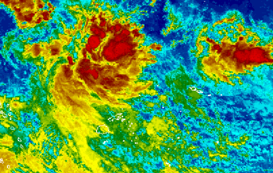
An active trough of low pressure lying to the north of Fiji is expected to affect the country from later today and over the next few days.
The National Weather Forecasting Centre in Nadi says the trough is slow moving towards the group, while a high pressure system to the far southwest continues to direct fresh to strong easterly winds over Fiji.
A strong wind warning remains in force for coastal land areas of southern and eastern Viti Levu and Vanua Levu, Yasawa, Taveuni and nearby smaller islands, Lau, Lomaiviti, Kadavu and nearby smaller islands.
These areas can expect strong east to southeasterly winds with average speeds of up to 46 kilometres per hour and gusts of up to 55 kilometres per hour. Seas are expected to be rough to very rough.
A coastal inundation alert also remains in force for southern low-lying coastal areas of Yasawa, Mamanuca, Viti Levu from Natadola through the Coral Coast to Navua, Taveuni, Lau, Lomaiviti and Kadavu.
The weather office says there is a risk of sea flooding in low-lying coastal areas, especially during high tide.
Cloudy periods with showers are expected over Navua, Suva, Nausori, Serua, Namosi, Naitasiri, Rewa, Tailevu, Ra, Vanua Levu, Lau, Lomaiviti and Kadavu.
Elsewhere, conditions will be fine apart from isolated afternoon or evening showers.
The weather office says showers are expected to become frequent, with occasional rain and isolated heavy falls developing from the north later today before spreading to the rest of the group.
It warns that localised heavy falls may lead to flash flooding.

