GEOGRAPHIC Information Systems (GIS) are not just tools but lifelines for islands in Fiji and the Pacific that are on the frontline of climate change, intense storms and shifting rainfall patterns that affect food security, livelihoods and essential services.
Minister for Rural and Maritime Development and Disaster Management Sakiasi Ditoka made the comment while opening the 2025 Pacific Islands GIS and Remote Sensing User Conference that begun in Suva yesterday.
He said the conference – gathering a powerful mix of minds from government, academic, industry and civil society – would allow knowledge exchange and strengthen the collective capacity to apply geography, geospatial technologies and remote sensing in ways that would improve lives, protect the people and sustain environments.
“As Minister of the Rural and Maritime Development and Disaster Management, I understand the Pacific faces extraordinary challenges that demand smart, data-driven solutions.
“Our islands are small in land area but immense in potential. Yet, we are on the frontline of climate change, more intense storms, higher seas and shifting rainfall patterns that affect food security, livelihoods and essential services.
“In this context, Geographic Information Systems (GIS), satellite imagery, drones and advanced data analytics are not just tools; they are lifelines.
“They help us map risk, plan resilient infrastructure, monitor ecosystems, manage fisheries and coordinate disaster response with speed and accuracy.
“Our focus must be practical and people-centered.”
GIS and remote sensing use maps and satellite data to monitor health, water, crops, disasters and urban needs. It helps forecast floods, track droughts, map disease risk, and plan clinics, schools and roads. Real-time dashboards and open data support faster, fair decisions that protect vulnerable communities, improve everyday life and ensure that resources reach those who need it most.
Mr Ditoka said in rural development, GIS helped plan infrastructure roads, water, electricity in a way that reduced costs, minimised environmental impact and served remote villages.
And in maritime development, he said accurate charts, oceanographic data and vessel tracking enhanced safety, enabled sustainable fisheries and supported blue economy initiatives.
“In disaster management, geospatial intelligence from hazard mapping and exposure analysis to real-time situational awareness means faster, more coordinated responses and better mitigation of future risks.
“This week, we celebrate what GIS and remote sensing allows us to do for the Pacific – know that you are the future of geospatial excellence, and our region’s well-being increasingly depends on geospatial insight.”
The minister said the work they did translated into tangible benefits.
“Your curiosity, your skills with data and your inventive use of new tools – AI, open-source platforms and satellite data will accelerate our path to resilience.”
He said the islands’ resilience lay in the cooperation and solidarity built across borders, and we owe a debt of gratitude to the many partners who believe in those values and support the conference – the Pacific Community
“We urge you to collaborate openly, to mentor others and to bring your ideas to life in ways that widen opportunity for communities across our islands.”
He implored delegates to use the conference to identify gaps, celebrate innovations and forge partnerships that turned data into action on the ground.
Pacific Islands GIS and Remote Sensing Council (PGRSC) chairman Bradley Eichelberger said the annual event encouraged collaboration across disciplines, helping ideas and techniques using satellite data and mapping to support real-time decision making and real-life applications. He said it sparked innovation, build capacity and fostered inclusive decision making, contributing to sustainable development and climate adaptation for the region’s communities now and in the future.
He added participants would share local research, solutions and products, raise the region’s profile and attract investment, talent, and partnerships that strengthened regional resilience.
“By encouraging open data practices, common standards and working with local stakeholders, the conference improves transparency, data quality and fair service delivery,” Mr Eichelberger said.
“We are honoured to host the event in Fiji, highlighting its commitment to sustainable development and disaster resilience.
“The conference showcases Pacific expertise, strengthens regional collaborations, geospatial innovation, capacity building and inclusive planning that benefits communities across the region,” he said.
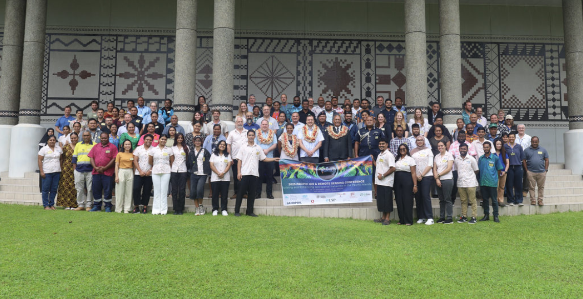
More than 300 delegates comprising scientists, companies, policymakers and regional GIS and remote sensing users are attending the four-day meet. The conference – themed ‘Building and enhancing networks in the Pacific Islands’ – continues today at the University of the South Pacific’s Japan Pacific ICT Hall at Laucala.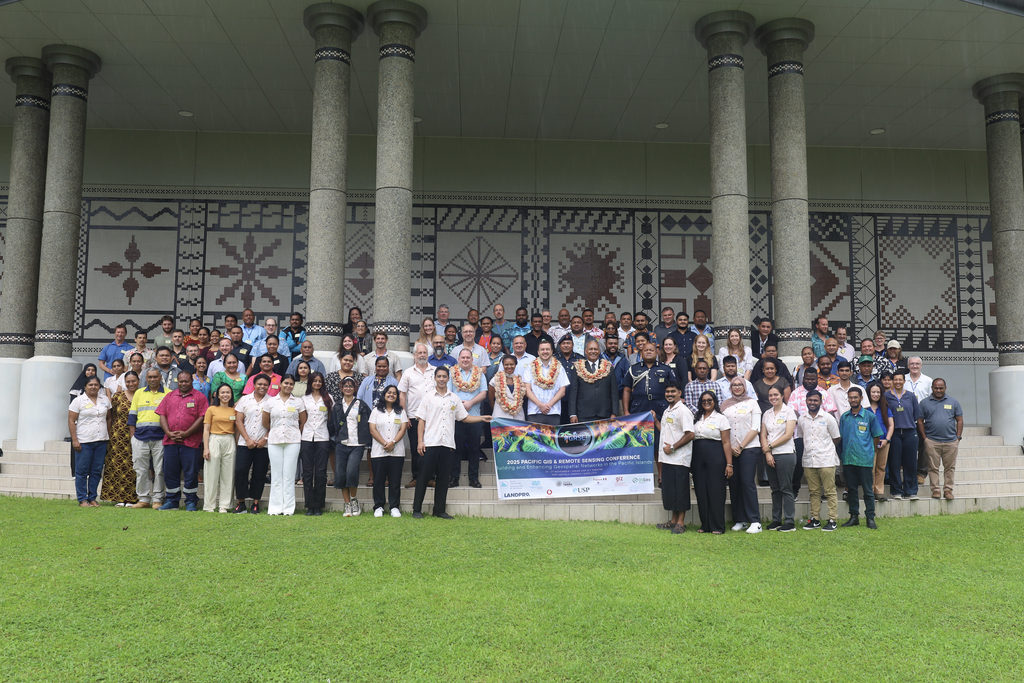
L-R (in garlands): PGRSC chair Bradley Eichelberger, program manager Digital Earth Pacific at SPC Andiswa Mlisa, USP’s Dr Stephen Galvin and Minister for Rural, Maritime Development and Disaster Management Sakiasi Ditoka with delegates of the Pacific Islands GIS and Remote Sensing User Conference 2025 at the Japan Pacific ICT Hall in USP, Suva. Picture: SUPPLIED
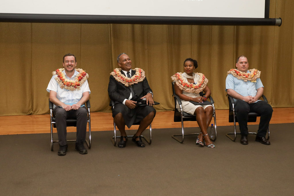
L-R: USP’s Dr Stephen Galvin, Minister for Rural, Maritime Development and Disaster Management Sakiasi Ditoka, program manager Digital Earth Pacific at SPC Andiswa Mlisa, and PGRSC chair Bradley Eichelberger at the Pacific Islands GIS and Remote Sensing User Conference 2025 at the Japan Pacific ICT Hall in USP, Suva.
Picture: SUPPLIED
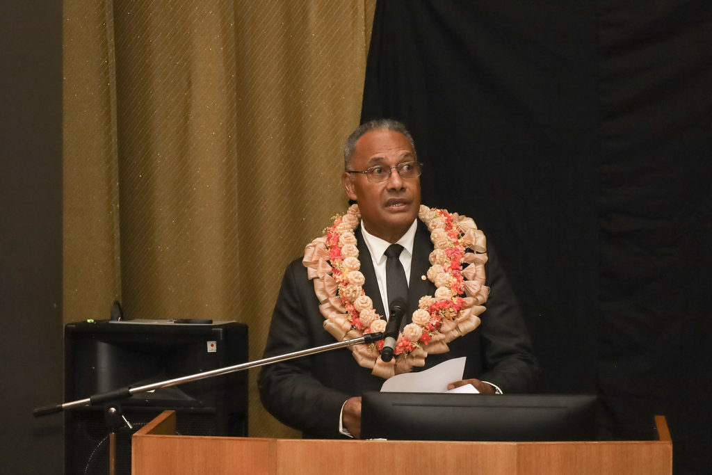
Minister for Rural and Maritime Development and Disaster Management Sakiasi Ditoka delivers his opening address at the conference. Picture: SUPPLIED

