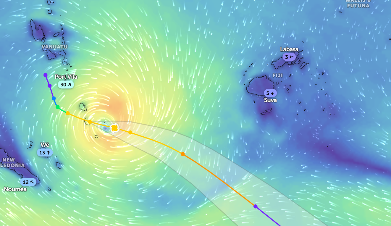
Category 1 Tropical Cyclone Urmil remains over Vanuatu and is expected to track southeast, passing southwest of Fiji, bringing strong winds and heavy rain bands to parts of the country from later today.
According to the Joint Typhoon Warning Center (JTWC), Tropical Cyclone Urmil is currently located about 237 kilometres south-southeast of Port Vila, tracking east-southeast at 20 kilometres per hour.
The system is generating significant wave heights of up to 6.7 metres.
On its current track, Urmil is expected to direct a strong and moist north-westerly wind flow over Fiji, increasing the likelihood of active rain bands affecting the group from later today.
Meteorologists say the steering environment will strengthen over the next 12 hours as a subtropical ridge elongates, allowing the system to accelerate southeastward.
Over the next 24 hours, Urmil is forecast to turn further southeast and move poleward.
While intensification has temporarily slowed due to wind shear and interaction with terrain over Tanna Island, conditions are expected to become more favourable once the system moves back over open waters.
Forecast models indicate a period of strengthening within the next 12 to 24 hours, with peak winds potentially reaching up to 150 kilometres per hour.
However, Urmil is not expected to maintain peak strength for long. Strong wind shear, dry air intrusion and cooler sea surface temperatures are forecast to weaken the system within the next two days, triggering a transition into a subtropical system between 48 and 60 hours.
Residents are urged to remain alert, follow official advisories and take precautionary measures as unsettled weather continues.

