THE Wainimala river still shapes life in the heart of what used to be called Colo East
The Wainimala river does not begin as one body of water but by smaller rivers and tributaries threading through the mountains of Colo East, gathering strength as they meet before flowing deeper into the interior of Viti Levu.
In Fijian, wai means water while mala, according to the David Hazlewood’s Fijian English – English Fijian Dictionary, refers to a fragment or a piece of something.
Joined together with the word ni, Wainimala can be understood as fragments of water coming together.
For generations, those flowing channels of water have carried the stories of the highlands.
British administrator and author Adolph Brewster once wrote in the late 1800s that the Colo East region was better known as Wainimala because of the river and its many tributaries spreading “in a veritable network over that part of the interior”.
More than a century later, the river still stretches across the land like veins through the mountains, connecting villages, feeding farms and sustaining daily life.
But while the Wainimala remains central to the identity of the region, its role has changed with time.
A river once travelled like a highway
Long before roads reached the rugged interior, villagers travelled almost entirely by water.
Bilibili rafts and small takia moved along the river and between villages, carrying people, crops and supplies.
Bananas, yaqona, root crops and even cotton grown by early European settlers were transported downstream in the early 1900s.
Today, the Serea-Laselevu Road cuts through parts of Colo East, linking villages across several tikina (districts). Trucks and carriers have replaced many of the journeys once made by bilibili and takia.
Yet despite the road developments, the river has never truly loosened its grip on the people who live beside it.
Villagers still depend on the Wainimala and its tributaries for washing clothes, bathing, cleaning, irrigation and freshwater. During dry days, children gather along the riverbanks to swim while farmers use the water to sustain crops.
And in some remote pockets of the interior, crossing rivers remains part of ordinary life.
Four crossings before the farm
After breakfast every morning, Timoci Rawakula is already preparing for the journey to his farm.
To reach it, he must cross the Wailoa river four times.
The Wailoa is one of the tributaries feeding into the Wainimala River system, winding through dense bushland near the Wailoa Power Station in the interior of Colo East.
For Mr Rawakula, the crossings are routine, but never easy.
“Before, many people travelled by bilibili from Laselevu and joined the Wainimala to get to nearby villages and towns,” he said.
“That was the way our fathers and grandfathers moved around.”
He said even after decades of change, many villagers still carry the same burdens their elders once faced.
“The challenge here in Laselevu is crossing the river,” he said.
“Our parents used to carry goods and household items across the water. Even hospital supplies and equipment are sometimes transported by bilibili or boats.”
When boats cannot be used, villagers wade through the river carrying loads above their heads.
“It’s not easy,” he said.
“But we continue to survive out here.”
Around him, the river moves steadily over stones polished smooth by generations of current.
The sound of flowing water is constant in Laselevu, familiar, dependable and at times unforgiving.
Schools built across the water
For villagers in the interior, the river has long shaped access to education.
The Wainimala Secondary School, Ratu Alipate Primary School and the local medical centre all stand in Laselevu Village, serving communities from several districts including Nagonenicolo.
For Osea Nabulivula, the river carries memories passed down from his father.
“One time my father told me they used to travel by water before,” he said.
“He said the school buildings were constructed when materials were brought across the river.”
Before the schools were established in Laselevu, many students travelled to Nakorosule Village for classes.
According to Nabulivula, the construction of roads into the area only came later with the development surrounding the Monasavu hydro project and the Wailoa Power Station.
“If there wasn’t a dam, we would probably still be travelling by water today,” he said.
Despite the road access, river crossings remain unavoidable for many families, especially during heavy rain.
“We hope things change in the future where bridges or Irish crossings are built,” he said.
“After so many years, we are still wading through water and catching dory boats to get across.”
During periods of flooding, the river can isolate communities for days. Students miss school, farms become inaccessible and movement slows to a halt.
Yet villagers have learned to read the moods of the river, knowing when it is safe to cross and when to wait.
“Life hasn’t really changed,” Nabulivula said.
“We still cross the river every day.”
Living with the river
In Botenaulu Village in the district of Muaira, farmer Lepani Tacikalou understands the river’s dangers all too well.
He grew up crossing the Wainimala River to attend Muaira District School at Lutu Village.
“We crossed it in the morning and crossed again in the afternoon,” he recalled.
“Later the school-built dormitories so students would not have to cross during school days.”
Now a father and farmer, Tacikalou’s relationship with the river has shifted from childhood routine to survival.
He once farmed closer to Botenaulu, but repeated flooding forced him to relocate to land nearer to the road.
“During heavy rain it became difficult for us,” he said.
“So, we decided to move our farming area somewhere more accessible.”
But even with the move, the risks have not disappeared.
Families in the interior depend heavily on farming for food and income, and waiting for floodwaters to recede is not always an option.
“Sometimes the river runs high for days,” Tacikalou said.
“Since we rely on our farms to survive, we would still cross the flooded river carefully because our families have to eat.”
“We hope there will never be an accident, but sometimes we do not have a choice.”
In a story published in The Fiji Times in 2019, Tulia Tulekula talked about her journey through the highlands of Naitasiri and the realities faced by villagers.
Tulia had walked for five hours from her husband’s village of Tuberua in the highlands of Naitasiri to go to Waibasaga, her village which is located close to Lutu, Wainimala.
She crossed the Wainimala River 32 times to reach the nearest point accessible by vehicle.
Tulia said if she left Tuberua at noon and kept a steady pace, she would usually arrive in Waibasaga by 6pm before darkness settled across the interior.
“If we have started walking at a certain time and we get stranded because of river flooding we often sleep at a nearby village and wait for the water to recede then we continue on our journey or return to the village,” she said.
“I pass several villages before getting to Sawanikula where the road is accessible and from there cross the river again to get to Waibasaga.”
The river that remains
Across Colo East, the Wainimala river continues to shape daily life in the highlands.
It no longer serves as the main highway it once was, but its presence still dictates where people farm, how children travel and how communities endure periods of isolation.
The river has watched generations grow along its banks, from the days of bilibili travel to the arrival of roads winding through the highlands.
And while development has reached parts of the interior, the waters of Wainimala continue to remind villagers that some journeys are still measured one crossing at a time.
History being the subject it is, a group’s version of events may not be the same as that held by another group. When publishing one account, it is not our intention to cause division or to disrespect other oral traditions. Those with a different version can contact us so we can publish your account of history too — Editor.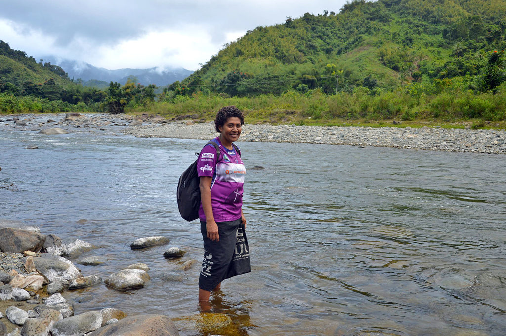
Tulia Tulekula crosses the Wainimala River to get to Waibasaga Village in the highlands of Naitasiri. Picture: ANA MADIGIBULI/ FILE
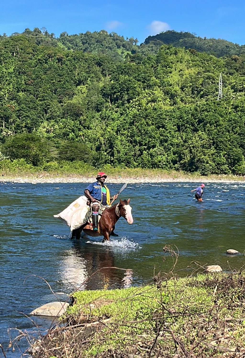
Osea Nabulivula of Laselevu Village of Nagonenicolo district crosses the Wailoa River with his family to go to his farm. Picture: ANA MADIGIBULI
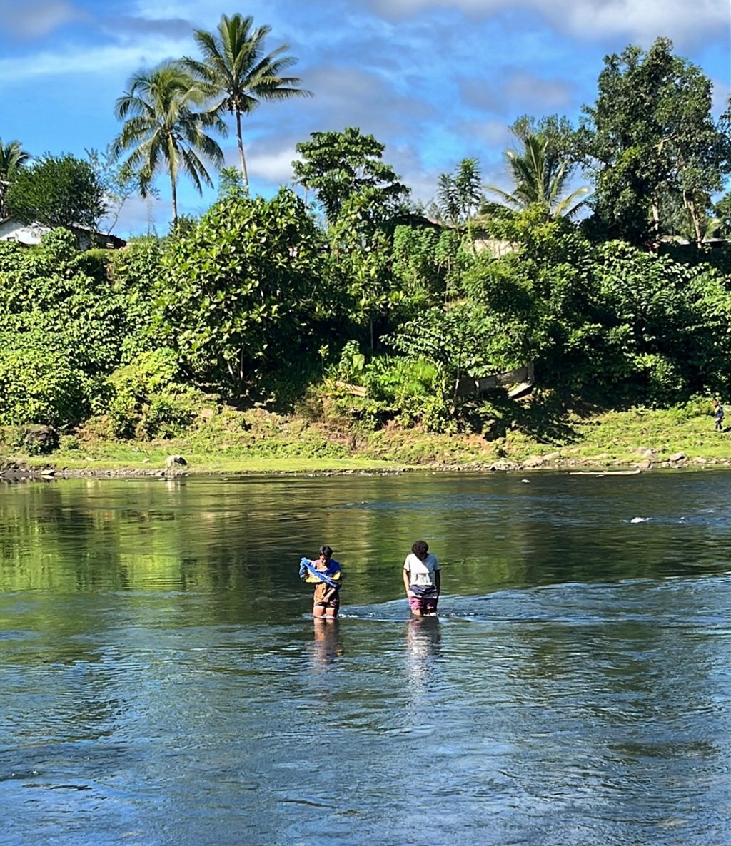
Children wade across the Wailoa river.
Picture: ANA MADIGIBULI
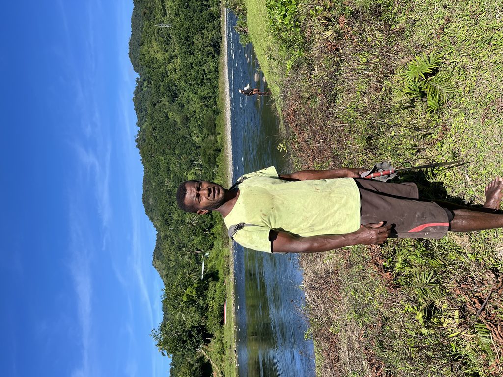
Timoci Rawakula crosses the river to get across to his farm. Picture: ANA MADIGIBULI
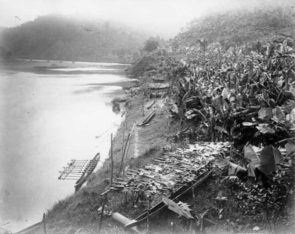
Nakorosule by the Wainimala river. Banana production thrived in the region during the colonial period.
Picture: SUPPLIED
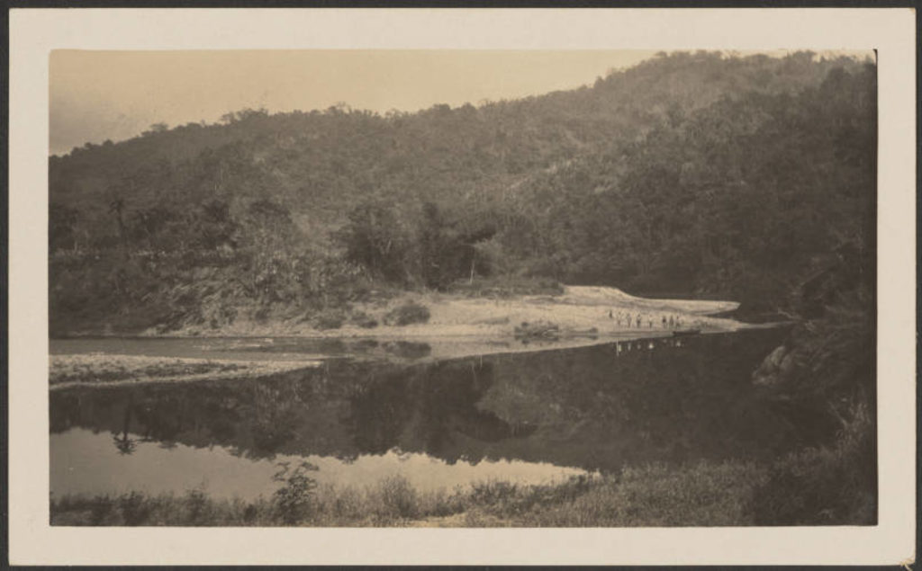
The Wainimala river at Draunidakua in August 1930. Picture: AUCKLAND COUNCIL LIBRARIES
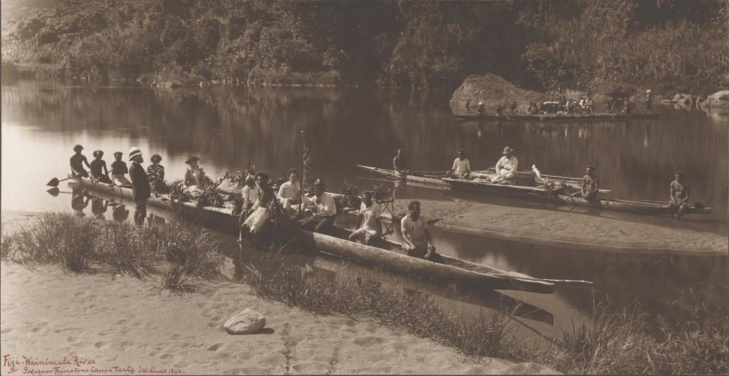
Governor Thurston often visited Colo East travelling up the Wainimala river.
Picture: WWW.NGV.VIC.GOV.AU
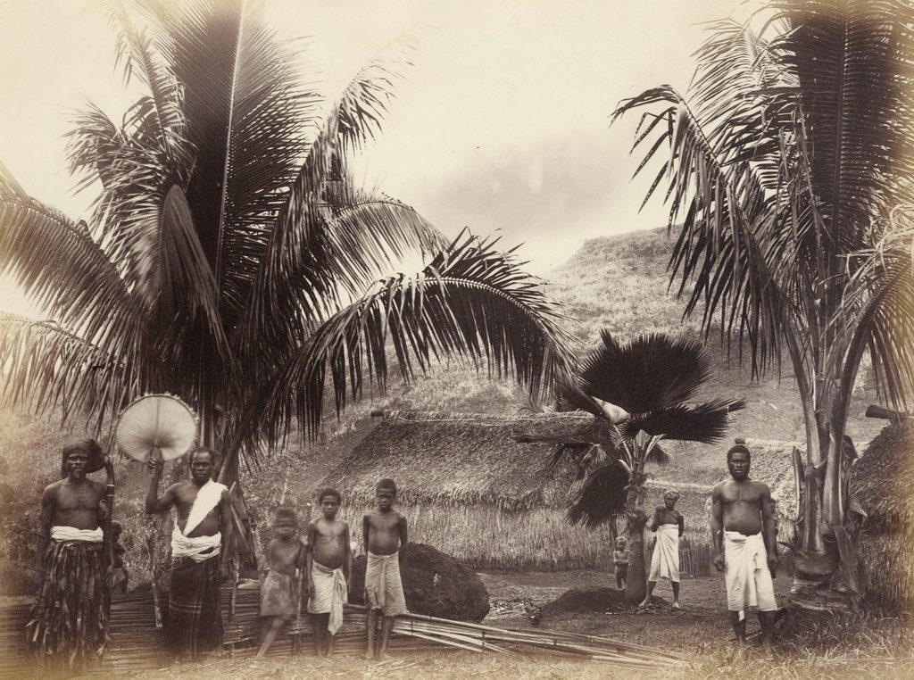
A Fijian village back in 1881. Picture: WWW.BONHAVIS.COM
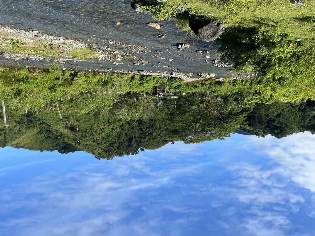
The Wainimala River does not begin as one body of water, it is formed by smaller rivers and tributaries threading through the mountains of Colo East. Picture: ANA MADIGIBULI