In Parliament today, Minister for Mineral Resources and Lands, Filimone Vosarogo, today outlined significant advancements in Fiji’s groundwater management.
The Department of Mineral Resources, under the Ministry of Lands, is tasked with managing Fiji’s groundwater resources, which are hidden beneath the earth’s surface, making them difficult to locate and measure.
“Groundwater is one of the world’s most valuable natural resources, yet its assessment is a challenging and risky task due to its invisibility,” Mr Vosarogo stated.
Traditionally, the ministry has relied on Electrical Resistivity Tomography (ERT), a non-invasive geophysical technique that generates 2D images of underground structures by measuring subsurface resistivity. These images identify features like perched aquifers, saturated zones, and geological faults, guiding borehole drilling targets.
While ERT has been instrumental since Fiji’s independence, Vosarogo noted its limitations, describing it as labor-intensive and time-consuming, which restricts the number of boreholes identified annually.
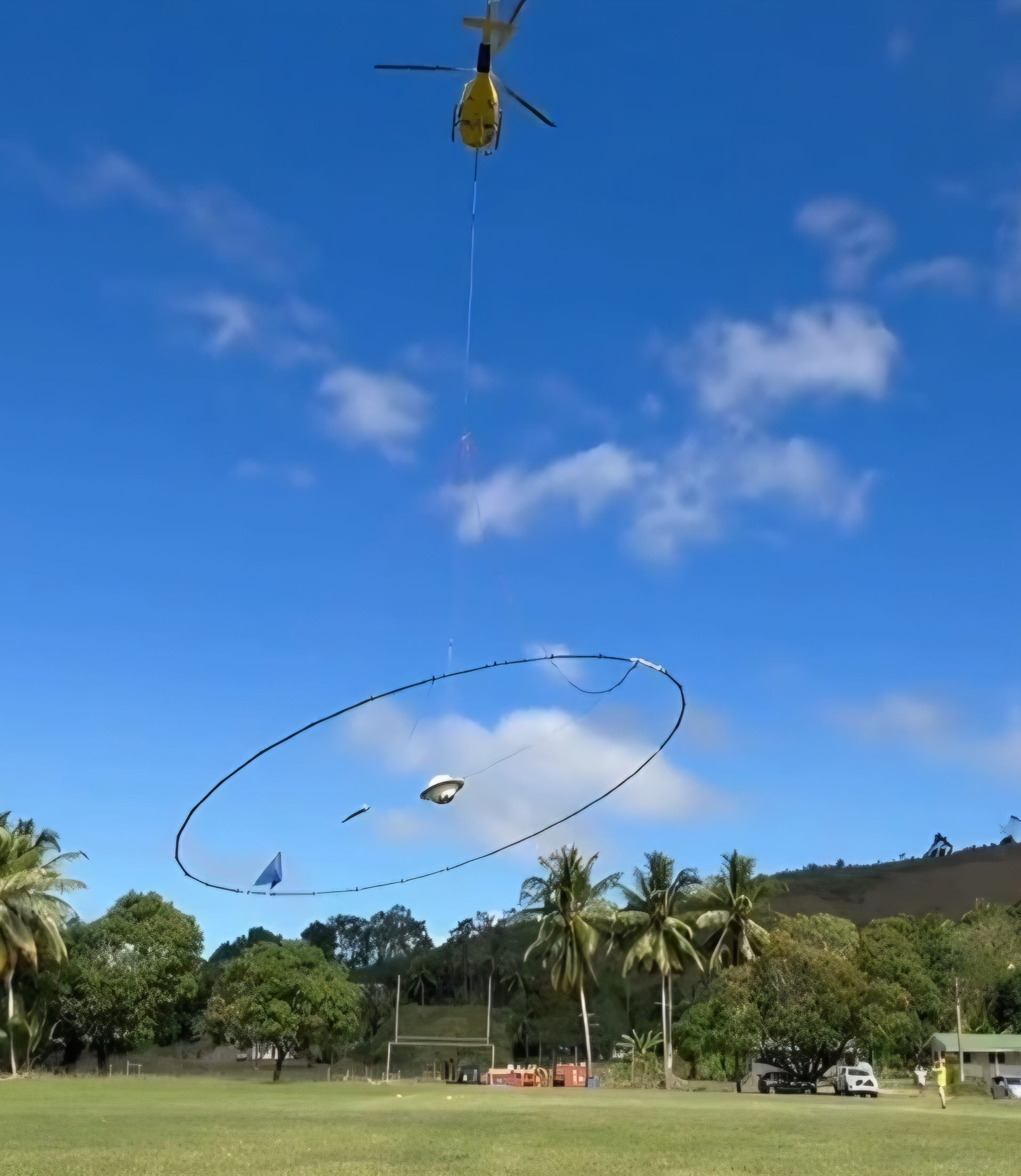
To address these challenges, the ministry has partnered with Geoscience Australia, supported by the Australian Government, to adopt airborne geophysical survey technology.
Launched last month, this method uses aircraft, including a helicopter with a 30-meter diameter formation, to survey large areas more rapidly and efficiently than ground-based ERT.
The ongoing survey, which will continue until November 2025, targets priority areas across Fiji.
‘The survey is expected to identify hundreds, potentially thousands, of drilling targets by December 2025,” he said.

