IF hydrography did not exist, safe navigation at sea would be a huge challenge.
This year the Fiji Hydrography Service (FHS) operating under the Republic of Fiji Navy with hydrographic offices around the world celebrated World Hydrography Day yesterday (June 21) with the theme “Seabed Mapping : Enabling Ocean Action”.
This year the Fiji Hydrography Service also turns 55, a great accomplishment for hydrography in Fiji.
Since its establishment in 1970, the Fiji Hydrographic Service has evolved from a modest government unit into a technically capable institution with growing regional influence and national responsibility.
Initially operating with limited resources and heavily reliant on international partners for hydrographic data and charting, the service has since built its capacity to conduct hydrographic surveys to international standards using modern technologies such as multibeam eco sounders, GPS positioning systems, and specialised data processing software.
Fiji Hydrography Service director, Commander Jervis Robinson said FHS has played a critical role in ensuring the safety of navigation within Fiji’s waters over the years.
He said in collaboration with the United Kingdom Hydrographic Office (UKHO), the service has facilitated the production and maintenance of both paper and electronical navigational charts (ENCs).
“Notably the 2025 release of the ENC for Yasawa-i-Rara marked a milestone in its ability to support rural maritime communities and contribute to national development priorities,” Commander Robinson said.
“Institutionally, the reactivation of the Fiji National Hydrographic Committee after over two decades of dormancy has enhanced inter-ministerial coordination and aligned hydrographic activities with the Fiji National Development plan and the country’s Blue Economy Framework.
“This coordinated approach allows hydrography to directly support marine spatial planning, maritime boundary delimitation, coastal resilience and disaster risk reduction.
On the global stage, Fiji is a member state of the International Hydrographic Organization (IHO), a member of the IHO Council, and the Vice-Chair of the South West Pacific Hydrographic Commission.
“These roles reflect the service’s growing leadership in regional ocean governance and capacity building,” Commander Robinson said.
“Today, the Fiji Hydrographic Service not only safeguards maritime navigation but also supports sustainable ocean management, environmental protection, and national economic growth, affirming its essential role in the governance of Fiji’s vast maritime domain.
On its operations, the service reports directly to the Commander Fiji Navy as stipulated in the Fiji Maritime Transport Act 2013, but the service’s work is regulated by the Fiji Maritime Safety Authority of Fiji.
The service also reports to the Ministry of Public Works, Meteorological Services and Transport with the permanent secretary for Transport co-chairing the Fiji National Hydrographic Committee.
As a national hydrographer himself, Commander Robinson feels honoured and appreciative of those who have come before him in that role.
“We cannot look at the future without appreciating our past and the last 55 years of existence has been a remarkable journey for the FHS evolving to support the demands of the mariner and supporting Fiji’s Blue economy.
On this year’s theme, Commander Robinson said it held profound significance for the service.
“The theme underscores the indispensable role of accurate seabed data in fostering safe navigation, sustainable development and informed maritime governance.
“Since FHS now possesses the capability to conduct hydrographic survey to International Hydrographic Organization Standards, the theme affirms its transition from dependency to autonomy.
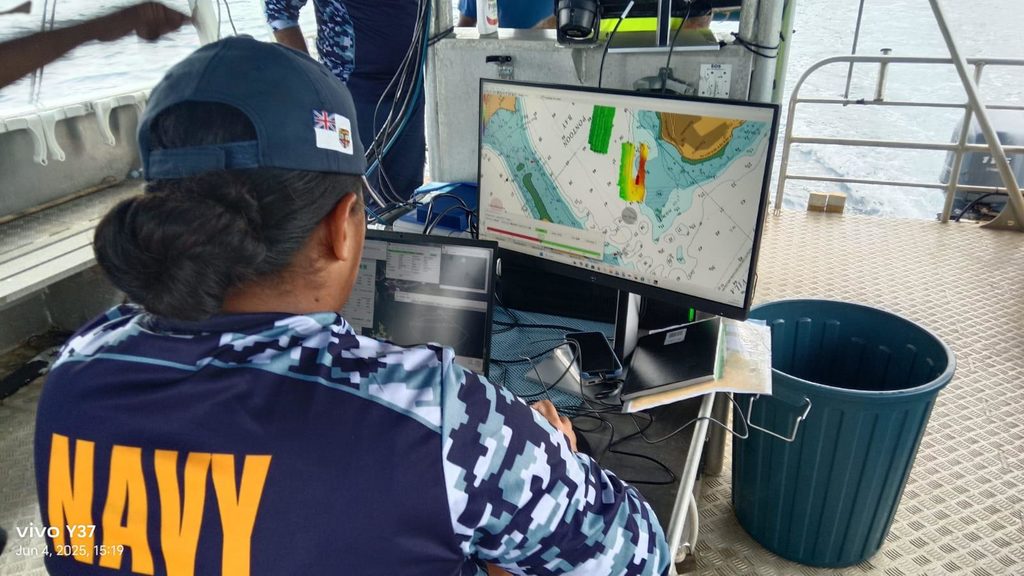
“Modern multibeam sonar, integrated GPS systems and advanced data-processing tools enable precise mapping of Fiji’s coastal and offshore zones – an essential foundation for risk-sensing, blue-economy planning and disaster resilience.”
For the service, “Ocean Action” means actively applying seabed intelligence to guide coastal infrastructure projects, optimising marine spatial planning, and bolster environmental stewardship.
“It also reinforces Fiji’s commitment to international frameworks like the UN Decade of Ocean Science (2021-2030), enabling the nation to contribute strategic data to regional and global hydrographic initiatives, such as Seabed 2030.”
Commander Robinson said the theme highlighted how robust seabed mapping serves as both a practical safety instrument and a strategic asset, empowered Fiji to manage its vast marine resources responsibly while elevating its presence in the global hydrographic community.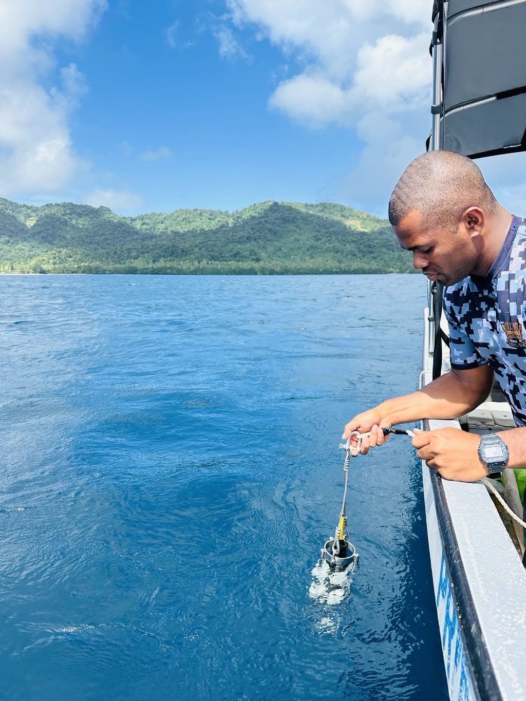
Initially operating with limited resources and heavily reliant on international partners for hydrographic data and charting, the service has since built its capacity to conduct hydrographic surveys to international standards using modern technologies. Picture: REPUBLIC OF FIJI NAVY
For the service, “Ocean Action” means actively applying seabed intelligence to guide coastal infrastructure projects. Picture: REPUBLIC OF FIJI NAVY
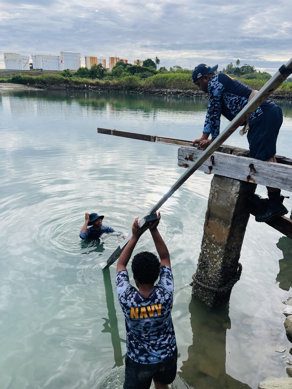
The service plays a critical role in ensuring the safety of navigation within Fiji’s waters.
Picture: REPUBLIC OF FIJI NAVY
The service now possesses the capability to conduct hydrographic survey to International Hydrographic Organization standards. Picture: REPUBLIC OF FIJI NAVY.
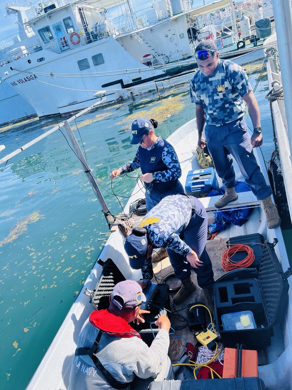
The service ensures chart accuracy through systematic hydrographic surveys using modern technologies. Picture: REPUBLIC OF FIJI NAVY
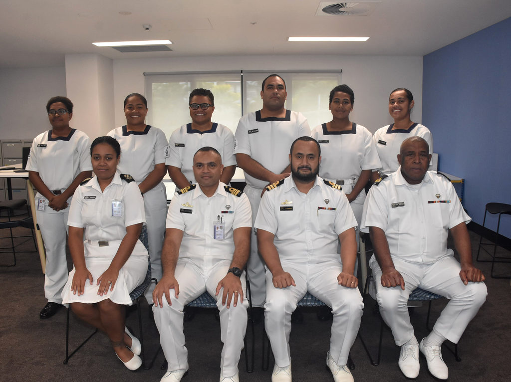
Fiji Hydrographic Services director, Commander Jervis Robinson (sitting second from right) with the Fiji Hydrography Service team at the Fiji Navy Maritime Essential Services Centre in Lami. Picture: KATA KOLI